
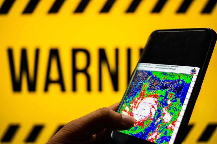
A storm’s label can fall faster than its dangers; Lala’s downgrade from hurricane to tropical storm reduced its peak wind, not the hazards that mattered most to Hawaiʻi—torrential rain, dangerous surf, flooding, and long, brittle outages that complicate recovery.
The Short Version
- Lala weakened to a tropical storm but still delivered damaging winds and torrential rain across multiple islands.
- Emergency managers and forecasters stressed hazard-specific risks—flooding, surf, debris, and power—rather than the category label.
- Tropical-storm-force winds with gusts near hurricane strength persisted, especially over higher terrain and windward coasts.
- Effective public guidance in Hawaiʻi prioritizes clear, action-oriented messages that match local hazards and timing.
What Lala actually did: wind eased, hazards did not
By the time Lala’s sustained winds slipped below the hurricane threshold, the system’s most consequential threats had already shifted to where tropical cyclones typically exact their toll in Hawaiʻi: flood-producing rain bands, long-period surf, and a sprawling field of gusts enhanced by topography. State emergency managers reported Lala maintaining maximum winds around 65 mph with the center about 75 miles southwest of Honolulu, a geometry that put Oʻahu, Molokaʻi, and Kauaʻi squarely in the path of the strongest gradients and rain shields. At the same time, the National Hurricane Center and Central Pacific Hurricane Center kept hazard-forward language at the top of their products—tropical-storm-force winds, gusts locally approaching hurricane strength, ongoing coastal hazards, and additional rainfall across windward slopes and higher elevations.
That combination explains why the public saw apparent contradictions in headlines—“downgraded” alongside scenes of homes awash and roads severed. There is no contradiction. The Saffir–Simpson scale tracks maximum sustained wind; the impacts Hawaiʻi endures most—flash flooding, landslides, coastal inundation—often do not peak where the scale peaks. Under Lala’s circulation and a humid maritime environment, 24–48 hours of efficient orographic lift translated windward moisture into feet of rain in favored belts, while lee-side corridors saw damaging gusts accelerate through valleys and along ridge lines as the pressure gradient remained tight.
How warnings worked: Hawaiʻi’s hazard-first playbook
Hawaiʻi’s emergency and forecast enterprise has evolved—by necessity—toward messages that put the hazard, location, timing, and action in plain reach. The state’s alert cadence and the Honolulu forecast office’s Area Forecast Discussions routinely break out what matters for each island group: when winds will peak, which coasts will see the largest surf and surge, where debris flows and rockfall are plausible, and how long runoff may persist after the bands pass. That approach reflects decades of social-science research on why some warnings spur action and others do not: people calibrate risk when they know what the hazard is, where it will manifest, how much time remains, and what to do about it, delivered by a trusted source [21,25].
Lala’s cycle showcased that model. Even as wind maxima eased, state and federal guidance emphasized post-storm lethality—electrical hazards, contaminated floodwater, unstable slopes, and carbon-monoxide risk from generator misuse. Those are not afterthoughts; they are the preventable causes of injury and death that cluster after the eyewall drama fades. Emergency updates underlined the geography of danger—Molokaʻi, Oʻahu, Kauaʻi in the wind peak; windward Big Island and Maui tapering in rain, with additional bands later—and the operational posture: where warnings remained in effect, where they were discontinued, and what that did and did not mean for remaining hazards.
Warnings, watches, and the signal in the labels
For a public trying to reconcile shifting advisories with what they feel outside, it helps to translate the taxonomy. Watches flag potential; warnings signal expected or ongoing conditions. As Lala evolved, tropical storm warnings expanded and contracted by island, mirroring the storm’s track and wind field. That is not inconsistency; it is precision—tightening the advisory map to match the hazard footprint in time. The discontinuation of a warning on one island does not mean the system is “over” statewide, just as a downgrade in category does not erase flood and surf risks downstream of the center. The Central Pacific and National Hurricane Centers’ forecast discussions went further, spelling out that gusts near hurricane strength could persist over higher terrain and that large, dangerous waves and coastal flooding would continue on east and south exposures—long after the headline label changed.
The operational benefit of that specificity is straightforward: emergency managers can align evacuation advisories, shelter operations, and power-restoration priorities with the highest-confidence impacts. The public benefit is clearer decisions—do I postpone travel along a windward highway prone to rockfall? Should I relocate vehicles from low-lying coastal lots before nightfall? Effective risk communication does not bury those answers deep in technical prose; it leads with them [21,25].
Mechanics of Hawaiian impacts: why “weaker” storms still flood and isolate
Tropical cyclones approaching Hawaiʻi encounter steep island topography that amplifies rainfall via orographic lift: saturated air forced upslope condenses into persistent, intense precipitation. Even when the vortex decays, remnant bands can park on windward slopes and produce dangerous runoff, especially where soils are thin and channels steep. On the leeward sides, channeling through saddles and valleys can turn a 50–65 mph gradient wind into 70+ mph gusts, enough to fell trees, damage distribution lines, and peel roofs. Those wind and water mechanisms are indifferent to whether the storm’s sustained wind ticks down by 10 knots.
Surf and surge hazards are similarly decoupled. Long-period swells generated during a storm’s stronger phase propagate ahead of and beyond the core; they refract and wrap into familiar hotspots on east and south shores, overtopping low-lying roads and accelerating beach erosion. Under Lala, forecasters flagged these coastal impacts explicitly, treating them as primary hazards rather than side effects of a waning wind field. The emergency posture followed suit—closing vulnerable frontages, warning against sightseeing near breaking waves, and anticipating debris clean-up on shoreline arterials.
What “torrential” means for infrastructure and recovery
Hawaiʻi’s lifelines—power, water, healthcare access, and inter-island mobility—operate with limited redundancy by mainland standards; a handful of transmission corridors, coastal highways hemmed between ocean and pali, and isolated communities that depend on a single passable route. In that context, “localized flooding” translates into consequential isolation. Under Lala, forecasters and emergency managers repeatedly tied the meteorology to concrete operational advice: avoid driving through floodwaters; expect continuing closures where culverts are compromised; keep generators 20 feet from structures to prevent carbon monoxide poisoning; return to damaged areas only when cleared by local officials. Those are the instructions that reduce secondary harm during the long tail of outages and debris removal.
Power restoration, in particular, is a sequence problem. Downed distribution lines and damaged transformers can be fixed in hours; compromised transmission spans, access impediments, and unstable slopes can extend repairs for days. Messaging that sets that expectation—prolonged outages are not neglect, they are a function of terrain, safety clearances, and aftershock hazards—helps communities pace their recovery, share resources, and reduce frustration-fueled risk-taking like DIY line clearance or improvised generator venting.
RESCUERS BECOMING THE RESCUED ON ARRIVAL 🚑🌊
Two Hawaii County paramedics responding to the chaos of Tropical Storm Lala on Saturday ended up having to scramble onto the roof of their own ambulance just to escape rising floodwaters.
Even the professionals taking the shift get…— Maria Mel (@Mariamelx58) August 17, 2026
Lessons reinforced: judge the storm by its hazards, not its headline
Every significant Pacific cyclone that brushes the main Hawaiian Islands carries the same communication challenge: the public anchors on a label; the physics punish that habit. Lala underscored why agencies here—and the best partners in media—front-load hazard, location, timing, and action. The record shows that approach improves comprehension and compliance across demographics when stakes are high and time is short [21,25]. As climate variability drives episodes of anomalously warm waters and altered steering currents, the islands will see more cases where rain and surf outrun the wind. The durable discipline is the same: heed warnings tuned to your district, not the category at the top of the crawler.
When the next system approaches, calibrate your decisions with the questions Hawaiʻi’s forecasters answer well: What are the peak hazards where I live? When do they start and end? Which roads, slopes, and shorelines near me have failed in past events? Which actions reduce my exposure right now? In a place where minutes of heavy runoff can take out a bridge and hours of wind can sever a transmission line that serves a valley, those answers matter more than whether the storm crests at 70 or 80 mph.
Sources:
youtube.com, dod.hawaii.gov, nhc.noaa.gov, mauinow.com