
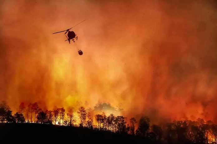
The Timber Fire surged again in Big Sur, forcing new evacuation orders and closing a key stretch of Highway 1 as crews fought flames in steep, hard-to-reach terrain.
Quick Take
- The fire reached **1,300 acres** by Monday afternoon and stayed **5% contained**.
- CAL FIRE said the blaze jumped from 800 acres earlier that morning.
- Officials expanded evacuation orders to more zones, including areas near the Ventana Inn.
- Highway 1 was shut down in the fire area to protect residents and support evacuation traffic.
Fire Growth Outpaced Crews
CAL FIRE said the Timber Fire grew from 800 acres in the morning to 1,300 acres by 12:25 p.m., while containment remained at 5%. Officials said the fire began on August 8 and is burning near Timber Top Camp in the Big Sur area. Local fire updates also described steep, rugged terrain and heavy fuels, which made access difficult for crews.
The fast growth fits a common wildfire pattern in coastal mountain country. Monterey County wildfire guidance says slope, fuel, weather, and topography all affect spread, and that steeper ground can increase the rate of fire spread. Natural Resources Canada also says fuel, weather, and topography control fire behavior, including rate of spread and intensity. In plain terms, hot, dry, windy conditions and steep land can turn a small fire into a fast-moving threat.
Evacuation Orders Expanded Near Big Sur
The Monterey County Sheriff’s Office ordered people out of zones MRY-F026 and MRY-F027, and the order included the Ventana Inn. Authorities also kept evacuation warnings in place for nearby zones as the fire kept changing. KSBW and other reports said the fire had already jumped from 400 acres to 800 acres overnight before it doubled again later in the day.
Those orders matter because Big Sur has limited escape routes and a long history of fire risk. When a fire moves quickly in that area, officials often choose a wider evacuation zone rather than wait for flames to get closer. That approach can frustrate residents and visitors, but it also reflects the reality that roads, smoke, and falling visibility can close down faster than fire lines can be built.
Highway 1 Closure Hit Residents and Visitors
Officials closed a section of Highway 1 in the fire area, which added pressure to evacuations and cut off a major travel route through Big Sur. Reports said the closure covered about 16 miles between Point Sur Lighthouse and Partington Canyon. The shutdown also affected access to popular destinations and lodging in the area, which depend on Highway 1 for nearly all traffic.
🔥Timber Fire scorches 1,723 acres in California’s Big Sur as firefighters continue efforts to contain the blaze in rugged, difficult-to-access terrain pic.twitter.com/8nJeO1TjyC
— Anadolu English (@anadoluagency) August 11, 2026
The closure shows how quickly one wildfire can ripple beyond the burn area. It can block tourists, delay emergency crews, and isolate homes and businesses along the coast. It also feeds a frustration shared by many people across the political spectrum: when a crisis hits, the public often learns about the risk only after roads close, evacuations begin, and local agencies are already racing the clock.
What Remains Unclear
Officials had not given a final damage estimate in the reporting reviewed here, and containment stayed low as of the latest update. The cause of the fire was not listed in the core official updates, so investigators have not yet tied the blaze to any specific ignition source. For now, the clearest facts are the pace of growth, the evacuation orders, and the closure of a critical highway corridor.
Sources:
nypost.com, kabc.com, nbcbayarea.com, youtube.com, fire.ca.gov, facebook.com, constructsteel.org, natural-resources.canada.ca